Explore The Best Hiking Places In Melbourne

by admin

Beyond the city’s bustling streets, Melbourne offers some of the most stunning natural landscapes, offering hikers and adventure seekers a chance to escape into the wilderness. Trekking, with its blend of physical challenge and serene exploration, becomes a gateway to experiencing the untouched beauty of Melbourne’s wilderness. From rugged coastlines to dense rainforests and towering mountain ranges, Melbourne and its surroundings are a paradise for outdoor enthusiasts. In this guide, we’ll take you on a journey through the best hiking places near Melbourne, showcasing the diverse array of trails and natural wonders waiting to be explored. Whether you’re a seasoned hiker or just looking for a scenic walk, these trekking destinations promise wonderful experiences for your thrilling journey.

1. Dandenong Ranges National Park
Eastern Sherbrooke Forest Walk

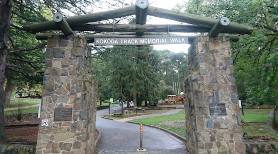
Escape the hustle and bustle of Melbourne and discover the peaceful Eastern Sherbrooke Forest Walk. It’s located in the Dandenong Ranges National Park, just an hour’s drive from the city. This walk takes you on a journey through a lush rainforest. Picture tall eucalyptus trees towering above and lots of ferns all around, creating a calm and tranquil setting. As you stroll along the path, you’ll get up close to the natural beauty of the area, especially the breathtaking Sherbrooke Falls. Keep your eyes peeled for some of the local wildlife, like lyrebirds and wallabies. They might make a surprise appearance during your walk.

With various trail options catering to different fitness levels, the Eastern Sherbrooke Forest Walk offers an ideal hiking experience for all, making it a year-round haven for nature enthusiasts seeking both beauty and knowledge. Whether you’re seeking a peaceful stroll or a challenging hike, this trail promises an unforgettable journey through the heart of Victoria’s rainforest wilderness, offering a welcome respite from the urban hustle and bustle of Melbourne.

Name Eastern Sherbrooke Forest Walk
Address School Rd, Tremont VIC 3786, Australia
Track Length 6.6 km
Walking Duration 2.5 hours
Difficulty Level Medium
Directions maps.app.goo.gl
Distance From CBD 39 km
How to Reach By Car: To reach Dandenong Ranges National Park travel via M1 and State Route 22 and you will reach your destination in approx. 40 min.
By Bus: Catch bus lines 907 and 688 to reach Dandenong Ranges, National Park.
Facilities Parking, Public Toilets, Picnic Tables, BBQs
Google Review – “Great place for a hike. Beautiful scenery. Whatever your fitness level is you can either take it slowly, and enjoy the magnificent scenic views, or, amp it up and really burn some calories (also whilst surrounded by majestic bushland).” – Charmaine Messina

2. Werribee Gorge State Park

Werribee Gorge Circuit Walk

A thrilling hiking destination near Melbourne, Werribee Gorge State Park invites adventure enthusiasts to explore its rugged beauty. The Werribee Gorge Circuit Walk, which is situated just a short distance from the city, offers panoramic views of towering cliffs and the meandering Werribee River, providing an ideal backdrop for hikers. With rock-hopping sections, the trail adds an exciting dimension, allowing hikers to get up close and personal with the park’s geology. The natural haven is home to abundant wildlife, including colourful bird species and wallabies, which adds to the allure of the place. The Werribee Gorge Circuit Walk offers trail options catering to various fitness levels, ensuring a rewarding adventure for all.

Make sure you are well-prepared for a moderately challenging hike with steep ascents and uneven terrain. It is essential to wear proper footwear and take safety precautions. The park’s attraction changes with the seasons, so decide what you want to see when you go, the spring wildflowers, the autumn’s vibrant greenery, or the year-round spectacular scenery. The Werribee Gorge State Park trail promises an unforgettable trip into Melbourne’s raw nature, which presents a dramatic contrast to the busy city streets, whether you’re seeking a day of discovery or a challenging hike.

Name Werribee Gorge Circuit Walk
Address 204 Myers Rd, Pentland Hills VIC 3341, Australia
Track Length 10 km
Walking Duration 4.5 hours
Difficulty Level Moderate-Hard
Directions maps.app.goo.gl
Distance From CBD 67.3 km
How to Reach By Car: Werribee Gorge State Park is around 1-hour drive from Melbourne CBD if you travel via National Highway M8. (The park is only accessible by car, as there is no public transportation)
Facilities Carpark, Toilet, and Picnic Area.
Google Review – “We did the Werribee Gorge Circuit route, with two children (10 and 8). Fantastic views and a bit of everything for us to see. Moderately difficult hike. Would definitely recommend.” – Paul Sciberras

3. Hanging Rock

Hanging Rock Summit Walk

Hanging Rock is a fascinating geological wonder located in the beautiful Macedon Ranges, within easy reach of Melbourne. The Hanging Rock Summit Walk is the perfect way to experience the area, taking you on a journey through this iconic formation and its stunning surroundings. The trail offers an up-close encounter with the enigmatic rock, which is renowned for its unique shape and cultural significance, famously depicted in “Picnic at Hanging Rock.” As you climb towards the summit, you’ll be treated to breathtaking views of the rolling hills and tranquil forests. The reserve also features picnic areas, providing an ideal opportunity to relax and explore nature.

The Hanging Rock Summit Walk, generally considered a moderate trek, invites adventurers of various fitness levels to explore this iconic natural landmark. While comfortable footwear is recommended due to the uneven terrain, the hike offers an enchanting blend of geological wonder, cultural allure, and natural beauty. Hanging Rock delivers an extraordinary hiking experience that continues to attract people with its unique charm and awe-inspiring views, whether you’re drawn to its mesmerising formations, its literary and cinematic fame, or the simple delight of an outdoor adventure.

Name Hanging Rock Summit Walk
Address 139 S Rock Rd, Woodend VIC 3442, Australia
Track Length 2 km
Walking Duration 1 hour
Difficulty Level Moderate
Directions maps.app.goo.gl
Distance From CBD 76.5 km
How to Reach By Car: Travel via Calder Fwy/M79 from Melbourne CBD, you will reach your destination in approx.1 hour.
Facilities Public Toilets and Picnic facilities.
Google Review – “A great place to hike especially it’s an old volcano that last exploded 6 million years ago. Have a small museum at the bottom to tell you the history of this hanging rock. It took us about 1 hour and 30 min to hike, take picture and sightseeing. A very good experience as it’s not that hard to hike.” – Cheong Mike

4. You Yangs Regional Park

Flinders Peak Walk

You Yangs Regional Park, located in Victoria’s beautiful wilderness, is a must-visit for anyone seeking an exciting trekking experience just a short distance from Melbourne. The Flinders Peak Walk, a highlight of the park, takes you to the summit, where you can enjoy breathtaking panoramic views. From the top of Flinders Peak, you can see the vast plains and distant Melbourne skyline, all surrounded by the beauty of nature. The park’s unique granite formations, such as the famous Big Rock, add an element of geological fascination to your adventure. While exploring the rugged terrain, you may encounter wallabies, kangaroos, and various bird species, making it a delightful experience for wildlife enthusiasts.

With trail options available for different skill levels, You Yangs Regional Park promises an inclusive hiking experience. To ensure a safe and enjoyable adventure, it is recommended to regularly check the trail conditions on the park’s website. The Flinders Peak Walk offers a unique opportunity to discover Melbourne’s natural beauty, including stunning summit vistas, geological wonders, and native wildlife encounters. Whether you are an experienced hiker seeking a challenging adventure or a nature lover looking for a break from city life, this trail promises an unforgettable journey in Melbourne.

Name Flinders Peak Walk
Address Turntable Dr, Little River VIC 3211, Australia
Track Length 3.2 km
Walking Duration 1 hour
Difficulty Level Moderate-Hard
Directions maps.app.goo.gl
Distance From CBD 54.3 km
How to Reach By Car: You Yangs Regional Park is approx. 1 hour drive from Melbourne CBD via M1.
Facilities Public Toilet, Car Park, Picnic Area, and BBQ.
Google Review – “Nice goto place if you want to warm up and do a small hike, it has a trail that will get you to the top for 30 to 45 minutes and there’s another long trail. A good place to reconnect with nature and see birds eye view of metropolitan melbourne and surrounding western suburbs Picnic area: Nice facilities for picnicking and even barbeque” – Ariel Marvida

5. Steavenson Falls

Keppel Lookout walk

Steavenson Falls, nestled within the Yarra Ranges, is a breathtaking natural wonder that invites hikers to explore the beautiful Keppel Lookout Walk. The trail takes you through the lush temperate rainforest, where towering mountain ash trees and vibrant ferns create a tranquil atmosphere. The sound of cascading water from the falls becomes a constant companion, especially after rainfall. These falls serve as a stunning backdrop for photography and are a monument to the beauty of nature.

Along the Keppel Lookout Walk, hikers may encounter native Australian wildlife, from colourful parrots to curious wallabies, adding to the delight of the journey. The hike ends at Keppel Lookout, which provides sweeping views of the falls and the surrounding forest area. This walk guarantees an amazing adventure for everyone who ventures into this natural beauty due to its accessibility to hikers of varied fitness levels and the relaxing retreat it gives into nature’s embrace.

Name Keppel Lookout walk
Address Falls Rd, Marysville VIC 3779, Australia
Track Length 11km
Walking Duration 3.5 hours
Difficulty Level Moderate-Hard
Directions maps.app.goo.gl
Distance From CBD 102.3 km
How to Reach By Car: To reach Steavenson Falls from Melbourne CBD go via Maroondah Hwy, it will take you approx. 2 hours.
Facilities Car Park, Toilet, and Picnic Area.

Google Review – “Beautiful waterfall with scenic views nearby. Serves as a great stop if you’re doing the “Keppel Lookout and Steavenson Falls via Tree Fern Gully Track” loop.” – Deashh Mahnn

6. Point Nepean National Park

Point Nepean Walk

Point Nepean National Park is an absolute gem for anyone looking to enjoy an exceptional hiking experience not far from Melbourne. The Point Nepean Walk is a trail that offers a delightful blend of historical wonders, challenging hilly terrain, and breathtaking coastal panoramas. As you meander along this path, you’ll step back in time and explore Australia’s wartime history through iconic structures like military forts and quarantine stations. So, if you’re seeking an unforgettable day out near Melbourne, you must include Point Nepean National Park in your hiking spot list.

A 14.5-kilometer return walk starting at the Point Nepean entry gate allows you to explore coastal and bush tracks, passing by the old Quarantine Station and World War II military buildings. The terrain is relatively flat and variable, making it accessible for hikers of different skill levels. The park offers both a glimpse into Victoria’s history and stunning bay views, catering to history enthusiasts, nature lovers, and those seeking an adventurous walk in beautiful and calming surroundings.

Name Point Nepean Walk
Address Ochiltree Rd, Portsea VIC 3944, Australia
Track Length 14.5 km
Walking Duration 3 hours
Difficulty Level Easy-Moderate
Directions maps.app.goo.gl
Distance From CBD 113 km
How to Reach By Car: Go via Mornington Peninsula Fwy/M11 from Melbourne CBD, you will reach your destination in around 2 hours.
By Bus: You can catch bus line 788 to reach Point Nepean National Park.
Facilities Toilets, Picnic Table, and BBQ.
Google Review – “I spent the entire morning hiking, and the scenery along the way was absolutely stunning! You can also choose to ride a bike or take a shuttle bus, which costs $12 for a round trip.” – SaSa

7. Organ Pipes National Park

Organ Pipes circuit

Last but not least, ‘The Organ Pipes Circuit’ located in Organ Pipes National Park is an amazing hiking spot near Melbourne. Organ Pipes National Park should be on your list. The star of the show here is the incredible Organ Pipes, which are rock formations shaped by ancient lava. They’re pretty unique and worth seeing. As you follow the trail, you’ll get to enjoy the beautiful Keilor Plains with colourful wattle flowers in the spring. Just keep in mind that to reach the top of the Organ Pipes, you’ll need to tackle a steep hill, which adds a bit of adventure to your hike. So, if you want a memorable hike that combines cool geological sights and the beauty of Australian nature, this park is one of the top picks near Melbourne.

The Organ Pipes Circuit in Organ Pipes National Park is a moderately challenging hike, featuring uneven terrain and some steep sections. It’s advisable to wear comfortable hiking boots and prepare for Melbourne’s changeable weather by dressing in layers and carrying water. So, if you’re in search of a captivating journey amidst stunning natural wonders and a touch of adventure, Organ Pipes National Park should be at the top of your list of hiking destinations in Melbourne. It’s an unforgettable experience that combines geological marvels with the splendour of the Australian wilderness.

Name Organ Pipes circuit
Address Organ Pipes Rd, Keilor North VIC 3036, Australia
Track Length 3 km
Walking Duration 30 min
Difficulty Level Easy-Moderate
Directions maps.app.goo.gl
Distance From CBD 29 km
How to Reach By Car: To get to Organ Pipes National Park from Melbourne CBD, take the M2 and Calder Fwy/M79. You'll be there in about 48 minutes.
Facilities Car Park, Toilets, Picnic Area.
Google Review – “It’s a small, peaceful scenic park. Not a large area but is quite accessible and easy to walk on. Path was mostly flat except at the start which was a little steep. Didn’t encounter stairs. There is a small river and besides the organ pipes, there are also rosette rocks and the tessellated path but they aren’t much to look at. Still interesting. Toilets and plenty of parking space” – Rachel Lim

Conclusion

Melbourne and its surrounding regions boast a variety of hiking destinations, each with its own unique charm and natural allure. From the iconic basalt columns of Organ Pipes National Park to the historical richness of Point Nepean National Park, there is a trekking experience to suit every adventurer’s preference. Whether you are drawn to geological wonders, coastal vistas, or encounters with native wildlife, Melbourne’s hiking places provide an opportunity to reconnect with nature, learn about history, and create lasting memories. These destinations not only offer a chance to escape city life but also remind us of the breathtaking natural beauty that lies just beyond the city limits. So, put on your hiking gear and get ready for the trekking adventure to discover the true beauty of Melbourne’s great outdoors.

You may also like

Day in Australia is your ultimate online resource for all things related to exploring and experiencing the beauty of Australia. We will showcase the best that this remarkable country has to offer. Whether you’re a seasoned traveller or planning your first visit, our comprehensive guides, insightful articles, and insider tips will help you make the most of your time in Australia.

Copyright ©2024 – All Rights Reserved.